
Delhi govt plans elevated corridors in north, northeast Delhi to decongest high-volume roads
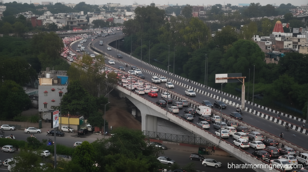
Delhi govt plans elevated corridors to ease traffic congestion
Bharatmorningnews.com – The Delhi govt plans elevated corridors in north and northeast Delhi as part of a major infrastructure initiative aimed at decongesting high-volume roads. According to officials familiar with the matter, two new elevated corridors will be constructed—one stretching from Britannia Chowk to Outer Ring Road, and another running from Ankur Enclave to Gokulpuri Metro station. These corridors will function as bypass arterial routes, providing relief to heavily trafficked roads including Outer Ring Road, Peeragarhi, Rohtak Road, and Wazirabad Road.
The north Delhi corridor will pass through Shakur Basti Railway station and Guru Harkishan Road, while the second corridor will traverse over the Karawal Nagar drain, senior government officials confirmed. This strategic positioning is expected to significantly reduce travel time for thousands of daily commuters who currently face severe bottlenecks on these routes.
Project Details and Timeline
The Public Works Department (PWD) has officially invited bids to assess feasibility and prepare detailed project reports for both corridors. Each proposed corridor is planned to be approximately five kilometres long. The total project is expected to cost ₹3.21 crore and take five months to complete, according to officials. This timeline reflects the government’s commitment to swift implementation of traffic management solutions.
Also read: PWD plans elevated road along Aruna Asaf Ali Marg to ease south Delhi traffic
According to PWD officials, the proposed flyover on Guru Harikishan Marg aims to reduce the traffic load on this route by creating a parallel route. This additional infrastructure will help distribute vehicular movement more evenly across the region’s road network.
“The stretch between Punjabi Bagh Chowk and Mundka Industrial Area is over 10 kilometres long and it frequently experiences severe traffic jams. During peak hours, congestion on Rohtak Road is so intense that commuting beyond Peeragarhi Chowk towards Mundka Industrial Area and Bahadurgarh becomes extremely difficult,” an official, who did not wish to be named, said.
The official further explained that this road connects the Outer Ring Road near Britannia Chowk at one end and the Mangolpuri flyover at the other. Constructing a flyover here will significantly ease access to the Outer Ring Road for residents and commuters in Mangolpuri Industrial Area, Shakur Basti Railway Colony, Rani Bagh Market, Rani Bagh, Shakur Basti, Sainik Vihar, and Keshavpuram.
The official added that this development will help alleviate persistent traffic congestion on National Highway 10 (Rohtak Road), between the Punjabi Bagh Metro Station and Mundka Industrial Area. This highway serves as a critical artery connecting Delhi to Haryana, making the improvement particularly significant for regional connectivity.
The second corridor is planned to be constructed over the Karawal Nagar drain to improve connectivity for residents of the densely populated Karawal Nagar, Shiv Vihar, Joharipur, and Dayalpur localities in east Delhi. This area has long struggled with inadequate road infrastructure despite its high population density.
Harish Bisht, a resident of Karawal Nagar, highlighted the challenges faced by local commuters. He noted that two arterial routes—Bhajanpura to Dayalpur/Karawal Nagar as well as Khajuri to Pawi cinema via Pushta road—face maximum congestion in the region. “These two routes also have maximum violations of traffic rules in Delhi. Police presence needs to be increased to regulate the traffic in short term,” he said.
PWD officials explained that while there are roads on both sides of the Karawal Nagar drain, their width is barely 25–30 feet. “Since all traffic from these densely populated areas moves along the roads flanking the drain, navigating the route during peak hours is difficult. A feasibility study will be carried out to assess the construction of a ‘caterpillar’ elevated corridor over the drain, and further plans will be formulated based on the study’s findings,” the official said.
The comprehensive studies will cover a survey of traffic volume, topography, and utilities that need to be shifted, as well as mapping the entire corridor length. “The consultant will help guide the entire process, including securing the permissions for tree cutting and shifting of utilities up to the project reports. They will also help in the execution of the project after bids are floated,” an official said.