
Monsoon slowdown likely to widen UP’s rain deficit
Monsoon Slowdown Likely to Widen UP’s Rain Deficit
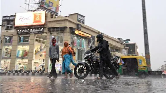
Bharatmorningnews.com – Rainfall in Uttar Pradesh has shown a decline since Saturday, prompting a renewed increase in the state’s monsoon rain deficit. For the first time since the monsoon season began on June 30, the deficit rose by one percentage point to 17% as of Sunday, according to the India Meteorological Department (IMD).
Regional Weather Forecasts
The IMD predicts that the monsoon current will weaken further in the next few days, potentially exacerbating the rainfall shortfall and contributing to rising temperatures, as noted by a weather official on Sunday.
Regional Rainfall Breakdown
From 8:30 am on Saturday to 8:30 am on Sunday, 40 out of Uttar Pradesh’s 75 districts saw no rainfall. The state’s overall average was 7.5 mm, with East UP recording 11.7 mm and West UP just 1.4 mm.
High Rainfall Districts
Bansgaon in Gorakhpur had the highest rainfall at 168 mm over the 24-hour period. Other notable districts included Mahsi (Bahraich) at 129 mm, Tanda (Ambedkar Nagar) at 125 mm, Mukhlispur (Sant Kabir Nagar) at 109.6 mm, Mankapur (Gonda) at 91 mm, and Nighasan (Lakhimpur Kheri) at 75.4 mm.
Surplus and Deficit Districts
Since June 1, Uttar Pradesh has received 158.8 mm of rainfall, compared to the normal 190.9 mm, resulting in a 17% deficit. West UP saw a 16% surplus, with districts like Meerut (194%) and Muzaffarnagar (191%) recording significantly above-normal rainfall. Meanwhile, East UP continues to face a 35% shortfall, with some areas receiving 138.2 mm against the expected 211.4 mm.
Regional Rainfall Categories
West UP’s districts are categorized into two groups: those with large excess (60% or more above normal) and those with excess (20% to 59% above normal). The former includes Meerut (194%), Muzaffarnagar (191%), Etah (114%), Sambhal (113%), Hathras (83%), and Firozabad (64%). The latter comprises Agra (52%), Auraiya (51%), Bijnor (46%), Bulandshahr (41%), Etawah (40%), Baghpat (33%), Badaun (30%), and Lalitpur (24%).
Twenty-three districts reported rainfall within the normal range, from 19% surplus to 19% deficit. These include Ballia, Bahraich, Balrampur, Banda, Barabanki, Chitrakoot, Farrukhabad, Gonda, Hardoi, Kannauj, Kanpur City, Lakhimpur Kheri, Mirzapur, Sultanpur, Bareilly, Hamirpur, Hapur, Jalaun, Kasganj, Mahoba, Mathura, Moradabad, Rampur, and Shahjahanpur.
The remaining districts face varying degrees of rainfall shortages, with 28 reporting below-normal levels (20% to 59% deficit) and 10 experiencing large deficient rainfall (60% to 99% deficit).
“The depression over the Bay of Bengal weakened into a low-pressure system after reaching southwestern Uttar Pradesh, then moved eastward. This is likely to result in light to moderate rainfall with isolated heavy spells in eastern Uttar Pradesh over the next three to four days,” said Atul Kumar Singh, a senior scientist at the Regional Meteorological Centre, Lucknow.
Weather Conditions in Lucknow
Lucknow recorded maximum and minimum temperatures of 35.5°C and 27.8°C, respectively. Since June 1, the city has received 95.9 mm of rainfall, falling short of the normal 166.8 mm, leading to a 42% deficit.
The IMD forecasts partly cloudy skies in Lucknow, transitioning to mainly clear conditions. Temperatures are expected to remain around 36°C for the maximum and 26°C for the minimum.
Monsoon Activity Trends
This week, monsoon activity in Uttar Pradesh stayed robust, with widespread showers bringing cooler weather to most regions. These showers reduced the overall rain deficit from 59% on June 29 to 17% by Sunday.
The IMD has also predicted rain or thundershowers in select areas of East UP, with isolated instances of heavy rainfall in the northeastern parts. No warnings have been issued for the rest of the state.