
Feels like home: How ‘digital twins’ are helping plan the future of our cities
Bharatmorningnews.com –
Feels Like Home: Digital Twins Reshape Urban Planning
The Power of Virtual Replicas in City Design
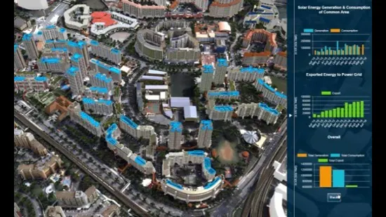
Feels like home—this phrase now extends beyond the comfort of a living space to encompass the evolving landscape of urban environments. Digital twins, which are highly detailed virtual replicas of real-world cities, are emerging as critical tools for planners and policymakers. By integrating real-time data, these models simulate city operations, from traffic patterns to energy consumption, enabling more informed decisions. Singapore’s Marina Bay Sands, for example, showcases how digital twins can track pedestrian movement and environmental conditions, offering insights into optimizing public spaces and infrastructure.
Global Implementation and Diverse Applications
Since 2017, Singapore has been a pioneer in deploying digital twins on a national scale, setting a benchmark for other cities. Over 500 urban centers worldwide now utilize such simulations, each tailored to address unique challenges. In Chattanooga, Tennessee, digital twins combine traffic cameras, emergency calls, and weather data to predict and mitigate congestion. Similarly, Western Sydney’s twin integrates 22 million trees, 540,000 buildings, and 20,000 km of roads to improve wildfire response and streamline zoning approvals. These models not only enhance efficiency but also foster resilience against climate-related threats.
Expert Perspectives on Urban Simulation
“Digital twins are not just static models—they are dynamic platforms that evolve with the city,” says Paul Cureton, a senior lecturer at the University of Lancaster and co-author of Geodesign, Urban Digital Twins, and Futures (2025). He highlights the importance of real-time data in making these simulations actionable. For instance, Helsinki’s digital twin focuses on energy efficiency, modeling flood risks, noise levels, and solar panel placements to guide sustainable development. Meanwhile, Rotterdam’s dual system—comprising a citywide twin and a specialized one for its port—tracks shipping logistics and flood defenses, demonstrating how these tools can adapt to multifaceted urban needs.
Accurate data is the cornerstone of successful digital twin implementation. Michael Batty, chairman of the Centre for Advanced Spatial Analysis at University College London, warns that the term is often overused, with some systems lacking the depth of interconnected data required for true utility. However, when executed properly, digital twins provide a holistic view of urban dynamics, enabling predictive analytics that can influence everything from disaster recovery to infrastructure expansion.
India’s Bold Move in Digital Twin Technology
India is increasingly embracing digital twins to tackle urban challenges. In 2024–25, Mumbai, Pune, Chennai, and Varanasi launched these models to combat monsoon floods, a recurring issue in densely populated regions. Varanasi became the first Indian city to create a 3D spatial twin, merging live surveillance with flood data to predict water levels and plan emergency responses. Pune and Mumbai have since refined their models, incorporating more granular data to improve accuracy. While these efforts are promising, challenges like outdated infrastructure and drainage systems persist, underscoring the need for sustained investment and innovation.
Moreover, digital twins are being integrated into India’s smart city initiatives, offering a blueprint for sustainable growth. For example, the twin of Bengaluru, a city grappling with traffic and water scarcity, uses data from sensors and satellites to simulate urban mobility and resource distribution. This approach allows planners to test scenarios and implement solutions without real-world disruptions, aligning with the concept of “Feels like home” by creating environments that are both functional and livable.
Collaboration and the Future of Urban Innovation
Digital twins also promote cross-departmental collaboration, breaking down silos in urban governance. By unifying transportation, energy, weather, and demographic data in a shared virtual space, governments can simulate interconnected scenarios. For instance, a digital twin might model how a new road construction project affects air quality, public transit usage, and housing availability. This integration of data streams ensures that decisions are evidence-based and adaptable to changing conditions, including climate change.
As cities grow more complex, digital twins are poised to become indispensable. They enable predictive modeling that can anticipate challenges before they arise, such as energy shortages during peak demand or infrastructure failures during extreme weather. With advancements in AI and IoT, these models will become even more precise, offering a “Feels like home” experience by aligning urban development with the needs of its residents. The journey toward smarter cities is not just about technology—it’s about creating spaces that reflect the aspirations and realities of the people who live in them.