
Santa Clarita Pointe Fire map, evacuation updates: Blaze threatens homes as warnings issued
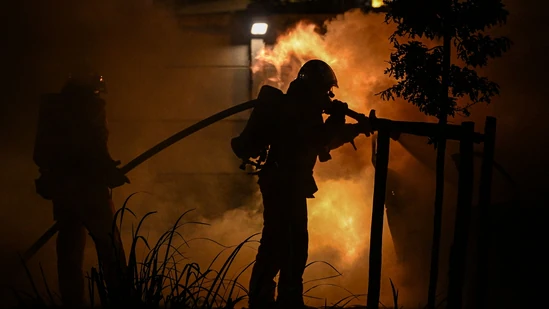
Santa Clarita Pointe Fire Map Evacuation Updates: Blaze Threatens Homes as Warnings Issued
Bharatmorningnews.com – The Santa Clarita Pointe Fire map evacuation is a critical tool for residents and officials monitoring the rapidly spreading wildfire near Center Pointe Parkway. As the Pointe Fire intensified on Wednesday, evacuation warnings were issued for homes in the affected area, prompting a swift response from Los Angeles County firefighters. Real-time updates are being shared through the official fire map, allowing residents to track the blaze’s progress and identify high-risk zones. This ongoing situation underscores the importance of staying informed and prepared in the face of natural disasters.
Fire Details and Response Timeline
According to ABC7, the fire was first reported at 1:40 p.m. local time, with a second alarm at 2:08 p.m. as crews mobilized to tackle the growing flames. By 2:15 p.m., approximately five acres had been consumed, and officials warned that the fire could expand to 100 acres within an hour due to dry conditions and strong winds. This rapid escalation highlights the urgency of the Santa Clarita Pointe Fire map evacuation, which serves as a dynamic resource for tracking the situation as it unfolds.
By 2:45 p.m., the blaze had grown to 30 acres, though firefighters were making progress in establishing perimeter control. Emergency reports indicated that homes along Doreen Place were at immediate risk, prompting additional evacuations. The Santa Clarita Pointe Fire map evacuation continues to be updated in real time, ensuring that residents have the most accurate information available to make informed decisions.
Transportation Impact and Evacuation Measures
Metrolink services between Via Princessa and Newhall have been temporarily suspended to facilitate the evacuation of residents from the Santa Clarita Pointe Fire area. The disruption underscores the extent to which the fire has impacted local infrastructure, with officials unable to provide an exact timeline for service resumption. Meanwhile, the Santa Clarita Valley Sheriff’s Station issued a statement via Facebook:
“An evacuation warning has been issued for Centre Pointe Parkway. Prepare to leave if you live here or are nearby. Consider leaving now if you need more time to evacuate. Call 911 for emergency assistance.”
A temporary reunification center has been set up at the Santa Clarita Aquatic Center, located at 20850 Centre Pointe Parkway, to help displaced residents. This facility provides a safe space for those seeking to reconnect with family members after evacuating. As the Santa Clarita Pointe Fire map evacuation updates continue to flow, the community is working together to ensure everyone’s safety and coordinate recovery efforts.
Impact on Local Community and Resources
The Santa Clarita Pointe Fire has disrupted daily life for many residents, forcing evacuations and creating a sense of urgency in the area. Local businesses and schools have also been affected, with some temporarily closed to ensure the safety of people and property. The fire’s spread has raised concerns about the potential damage to infrastructure, including roads and utility lines, which could further complicate evacuation efforts.
Authorities are working to provide resources to those displaced by the Santa Clarita Pointe Fire map evacuation, including food, water, and shelter. The temporary reunification center has become a vital hub for residents seeking assistance, with staff available to help with basic needs and connect families. As the fire continues to threaten homes, the community remains vigilant, relying on the Santa Clarita Pointe Fire map evacuation to guide their actions.
Current Fire Status and Spread
As of the latest Santa Clarita Pointe Fire map evacuation updates, the blaze has consumed over 50 acres and is expected to continue expanding. Firefighters are working tirelessly to contain the flames, using water trucks and aerial support to create firebreaks. The fire’s behavior is being closely monitored, with conditions worsening due to high temperatures and low humidity, which have made the area highly susceptible to rapid spread.
Residents in the affected zones are advised to monitor the Santa Clarita Pointe Fire map evacuation for real-time changes in the fire’s trajectory. The map also highlights the areas under threat, with particular emphasis on neighborhoods adjacent to Center Pointe Parkway. As the fire moves closer to residential areas, the need for continued vigilance and prompt action remains paramount.
Authorities and Emergency Response Coordination
Emergency personnel, including firefighters, paramedics, and law enforcement, are working in tandem to manage the Santa Clarita Pointe Fire map evacuation. The Los Angeles County Fire Department has deployed additional resources to the area, while the Santa Clarita Valley Sheriff’s Office coordinates the movement of evacuees and ensures roadways are clear for emergency vehicles. This collaborative effort is crucial in minimizing the risk to lives and property as the fire continues to spread.
Residents are encouraged to follow the Santa Clarita Pointe Fire map evacuation updates and heed the warnings issued by officials. Communication channels, such as social media and local news outlets, are playing a key role in disseminating information quickly. The combined efforts of the authorities and the community are helping to keep the situation under control, though the fire’s potential for further growth remains a concern.